Hiking the Harder Kulm - Switzerland

I found myself in Switzerland for a few days of adventure, hiking and biking in the glorious alps.
Interlaken was the base. It is not only ideally situated between the two picture-postcard lakes of Lake Thun and Lake Brienz, it is also ideally located to get out and about into the wider surroundings of the Swiss Alps, with a great network of trains to get you here, there and everywhere.
In this new post, I will focus on a hike right in the very centre of the popular Swiss Alpine destination called Interlaken. This is a relatively straightforward hiking route and a route that is popular with visitors from all around the world.
Hiking routes
There are a variety of routes up to the top of the summit of Harder Kulm. Although not particularly that high, some hiking routes are more comfortable than others, so attempt to make the right choice when starting.
Most of the hiking routes leave from the centre of Interlaken, one to the west of the town, one by the funicular and the one I took near the village of Goldswil.
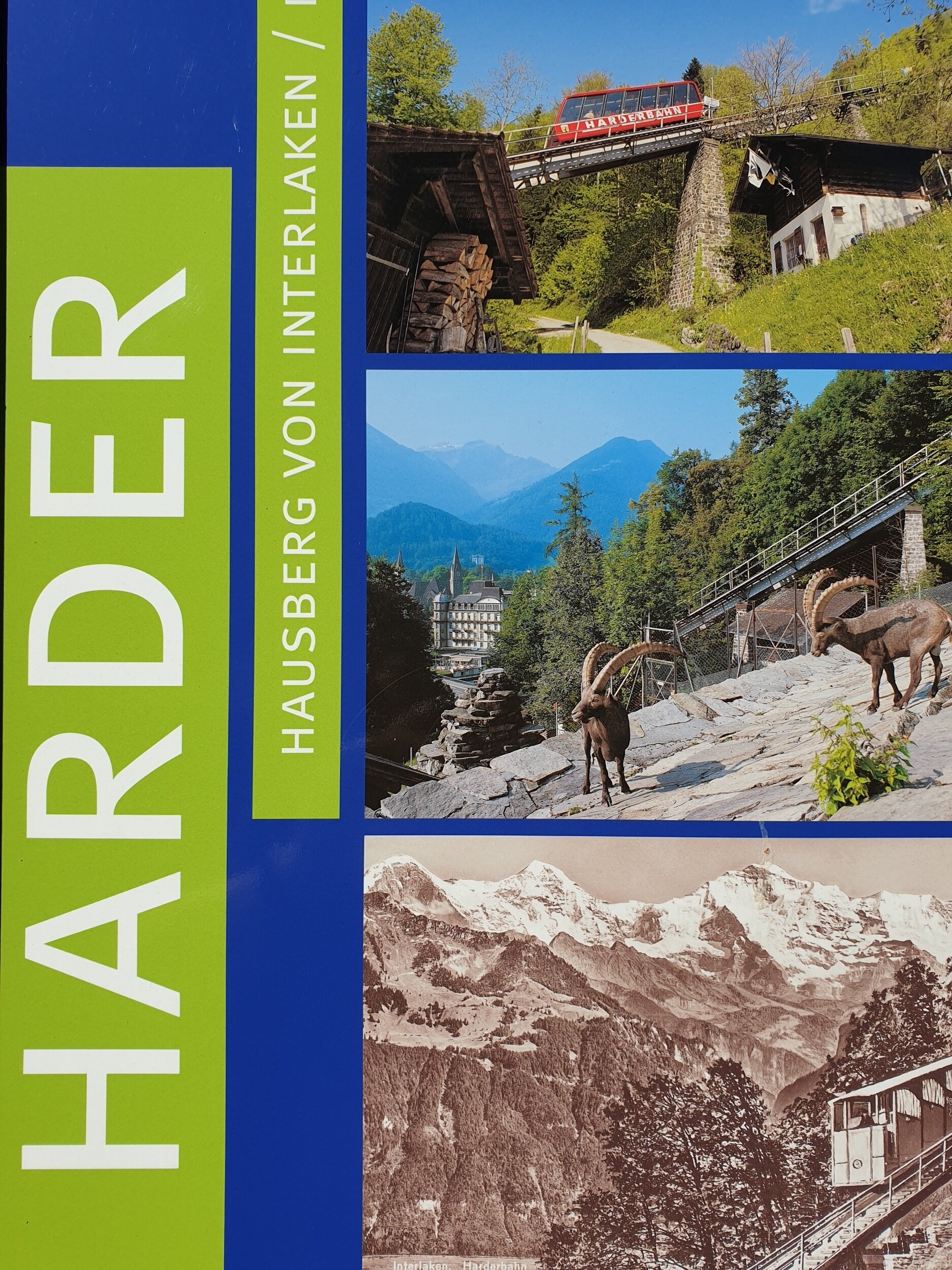
Of course, if hiking is not your thing, you don't have to walk to the top. If you want the most comfortable option, it would be to take the funicular railway, which will get you there in luxury and the chance to revel in some of the most amazing panoramic views of Interlaken and the surroundings. The funicular railway will take around 10 minutes to travel from the bottom station to the top. At the top, there is a short walk to the very top and the restaurant, additional hiking routes and viewing points.
The average gradient of the railway in 64% and the altitude above Interlaken is 754 m.
All of the routes are through pretty woodland areas, which straddle the whole mountainside for many miles. It is rich in coniferous forests, and the grit paths become lined with inviting avenues of trees. It not only makes for a vast canopy of shade on those warmer, sunnier days, but it can also offer shelter from the wind, as well as make for a pretty picture or two.

Image: Wikipedia
On route, there are several places where you can stop to sit and admire the views or listen to nature and reflect on what you see around you. There are one or two waterfalls running down from the top and during periods of high rainfall, these can be pretty impressive to watch.
As previously mentioned some of the routes can become a little steep in places, but nothing is too strenuous when you consider what other walking paths you might encounter in the alps, and I am sure if you take your time you will enjoy the challenge of reaching the top.
In addition, I would offer the advice of wearing suitable footwear and to be careful when the rocks underfoot become wet.
At the top and along the ridge are many amazing viewpoints of the surrounding area.
At the top
Once you arrive at the top, the view down into the valley below is pretty special. You will have a magnificent panorama and view of Lake Thun to the right, Lake Brienz to the left and the Aare river that connects the two, right in the city of Interlaken. It is gorgeous, and the crystal blue waters draw you to dive in, although from up here that would be quite an achievement. It is the longest river in Switzerland. It falls from the Grimsel region and then crosses the deep canyon, the up to 200 meters deep Aare ravine. The river then flows towards the lakes.
As you walk around the summit, there is a convenient viewing platform that juts out of the mountainside and has quite the drop below. To stand here is pretty unique as it gives the impression of falling away from the mountainside into the valley below.
It generates a popular attraction for the many tourists who gather here to enjoy. It is perfect for capturing images and precious memories from their trip. If you look out from this point and across the city limits of Interlaken, you will see the most iconic and memorable image of the Bernese Oberland mountain range and in particular the three majestic peaks of the Eiger, Monch and Jungfrau.
On a clear day, they look immense, and you will notice the prominent North Face of the Eiger, together with the observation station on the Jungfrau. At over 4,000 metres it is an awe-inspiring spectacle, and any visitors to the region cannot help but admire nature at its best.
From here, the snow-capped peaks look as amazing as they should and provide a beautiful backdrop to this impressive region.

The restaurant at the summit has some fine views for you to savour over a meal or drink.
Restaurant
At the top and one place not to miss is the restaurant. It can get busy here on a sunny day. Still, it is well worth a stopover or time to refresh. The Harder Kulm Panorama Restaurant not only has gorgeous views, but the range of food is good, and the service was surprisingly efficient.
There is an extensive seating area both inside and outside of the restaurant. It can house the many hikers and tourists who pass through.
The food is traditional and tasty, with a wide range of hot and cold platters as well as drinks. They make their own ice cream, and on a hot day, this is worth the hike in itself. Once again, the views are stunning, and the walk itself is also fantastic as you get higher up with better and better views of the area below.
There is a good range of food items, from sitting down in the restaurant and enjoying table service or choosing from a variety of snack options outside.
The terrace area outside is very popular with walkers and the canopies mean that you are able to still sit and eat no matter what the weather throws at you.

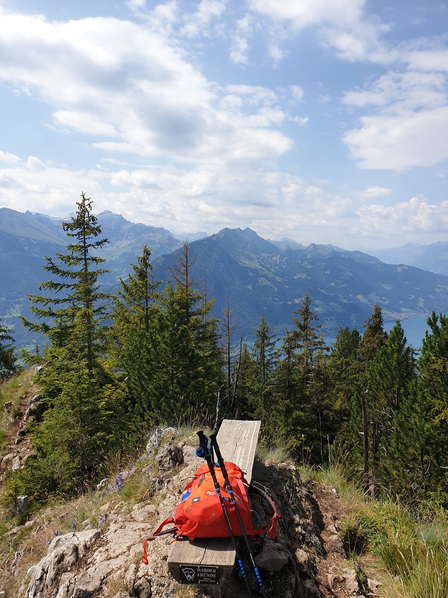
Hardergrat region. Image: Outdoor Journal
Other routes
Although the most direct route is around 3 km once at the top, you can easily link into some long walks and higher peaks. I chose to hike a little higher and further. I reached a peak in the Hardergrat hiking region.
Still, there are many other walks along the ridge, with the Augstmatthorn (2,137m) being close by and a mountain featuring a ridge trail with dramatic lake views, with ibexes and bird habitats dotted all along.
To attempt these routes, you will need more time set aside and to have more experience as a hiker, as they could be rather challenging to some. Most people who tackle these peaks after taking a ride up on the funicular. They then begin the walking routes from the top of Harder Kulm.
In order to help with my hiking routes and find new ones, I would like to walk. I tend to use app-based hiking routes like AllTrails. This great hiking app allows you to search for hiking routes in any location and all routes are verified by walkers who have completed them. Once I carry out the hiking route, I tend to record it using my Garmin watch and then upload the walks to my Strava account. That way it becomes a point of reference if I would like to do it again or perhaps inspire others who follow my account.

Walking route to Harder Kulm Image: AllTrails.com

The Harder Bahn is situated at the bottom of the mountain and in close proximity to the centre of Interlaken and Interlaken Oost railway station.

All walking routes are well signposted.

Most of the hiking trails are lined with trees.

In some locations the trees disperse into open areas and the views are stunning.
Around the city of Interlaken there are plenty of information boards sharing more information about what to see and do in the vicinity.
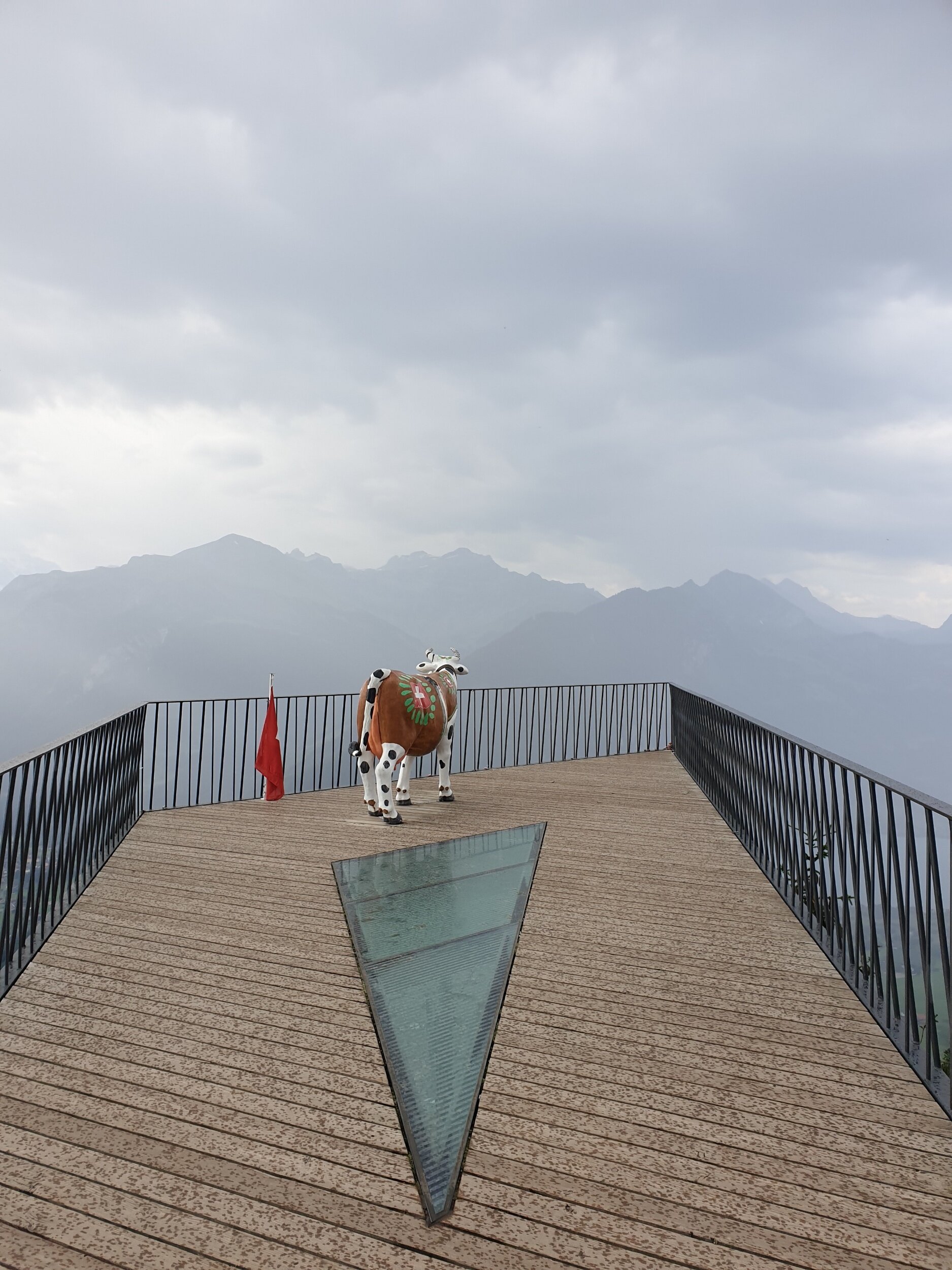
The viewing platform positioned at the top is ideal for memorable views into the valley below and mountain scenery beyond.
Thanks for reading
This short summary of one of the popular walks around Interlaken. It is a great walk to start with, if you are staying in the area and it is definitely worth a few hours out of your day, to enjoy this scenic route.
You can find more information on the region and others here. You can also follow more of my day to day imagery and stories here.
To help with the walking routes in Switzerland I down the Swiss Mobility App. This amazing little app allowed me to hike my way around, find routes and feel confident I was always on the right track.
You can also access the same hiking interface online. That is available here: Swiss Mobility. It has in-depth maps for hiking, but also for cycling, mountain biking and canoeing.
For more information on receiving 70% off selected brands at Cotswold Outdoors click below.